Showing posts with label Vaughan BUG. Show all posts

Sunday, July 5, 2015

More York Region Bike Month highlights

Bike Month 2015 has come and gone, but I had some memorable cycling experiences.  Here are a few more photos from some events in York Region that I participated in.

York Region Pedalpalooza - Tom Taylor Trail in Newmarket


Myles from Spoke O Motion set up some bike demos.  A quality bike makes such a difference in your cycling experience.  I rode my first tandem and fat bike!


Tom from Bike Sports showed off some different types of bikes including an electric bike.  Going faster and further with some power assistance makes me want to use a bike for more trips.  Pat from Smart Commute was there with her new e-bike.


Vaughan Bicycle User Group hosted two rides.  The Napa Valley Bike Lane celebration went from Sonoma Park to McMichael Gallery in Kleinberg.

Hydro Corridor trail south of Sonoma Park

Odette checking the map on the William Granger Greenway

The other Vaughan BUG ride was a Peter Rupert Bike Lane Celebration.  Starting from Walmart at Major Mackenzie / McNaughton, we biked south on Peter Rupert/Confederation to Hwy 7 with a stop for refreshments at McDonald's, and back north on the Bartley Smith Greenway.


I participated in the Toronto Bike Network's Dim Sum Ride.  The ride was led by Fred (who I previously met at Bike to Work Day Newmarket), and had about 10 cyclists.  We started at Finch Subway Station and headed north to Markham for an authentic chinese cuisine near Pacific Mall.

Finch hydro corridor in Toronto

Locking our bikes before lunch

Bike Month York Region had many other events, like bike valets at festivals, charity rides, mountain bike races, and kids bike camps. 

I'm all geared up for more cycling through the summer!

Here's another video to get you inspired to ride your bike.


Saturday, April 18, 2015

You cycled where?!?

Vaughan Mills Mall, located in Vaughan at Highway 400 and Rutherford Road, is a shopping and entertainment complex of colossal proportions. With over 1.2 million square feet (110,000 m²) of retail space, all on a single floor, it is the 11th largest mall in Canada and 6th largest in the GTA.

It's often a stressful drive to get there, particulary during the evening rush or on weekends.  This is the result of car-centric planning, which has consequently made every other mode seem difficult and uninviting.


I rode my bike there last week.  My route was mostly on minor roads (except a short segment on Jane on the sidewalk), it was quick (quicker than a car during rush hour), and relatively easy.  The most challenging part of the ride was crossing the 4-lane ring road that surrounds Vaughan Mills.  The intersection circled in red below is a controlled by stop signs, which ends up being really unconfortable to cross by bike or two feet.  It's not often that you see such a big intersection controlled by stop signs.  The crosswalk doesn't even have curb cuts.


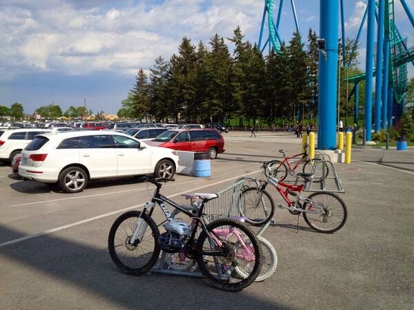
The second issue I have is with the bike parking.  Their website clearly says 16 bike racks at each main entrance (in addition to 6300 free parking spaces for cars).  I biked around the mall and found a total of 6 bike parking spots for the entire mall (2 spots at entrance #2, and 4 spots at entrance #4).  Entrances #1, 3, 5, and 6 had no bike parking, unless you count the light poles. 

For what is such a significant urban centre, and traffic generator, I expected better.

Entry 1

Entry 3

I didn't see any bike parking at the Transit terminal at Vaughan Mills either.

One ring and post at Entry 2

Two ring and posts at Entry 4

Here's my bike route from Vaughan City Hall to Vaughan Mills Mall.


If you ask most people, they'd think it is crazy to ride your bike to Vaughan Mills.  I would say they are crazy not to.  Have you seen the traffic on Rutherford Road at 5pm?  You can by-pass that traffic on a bike, and arrive with a smile on your face.

Saturday, April 4, 2015

Community Bike Ride for Vaughan's Earth Hour

On March 28th, I participated in the Vaughan's Earth Hour event held at City Hall.  It included a night bike ride hosted by the City of Vaughan and Vaughan Bicycle User Group.


The festivities included a energy conservation expo.


Here's the Vaughan BUG table.  The group encourage residents to give cycling a try for commuting and recreation.


People were asked to fill in the blank.  "My Bike is My..." escape; fresh air; keeping fit; fun, etc.  A bike is many different things to many people, and all of it makes life better.


The 7 km bike ride offered a the opportunity for a group ride through the community, to socialize with other cyclists, and communicate that people in Vaughan do cycle.  It showed that a night ride in March can be quite enjoyable, and is very commonplace in many cities.  Cycling can be a year-round activity, even in our climate.


Here's the route, which started at Vaughan City Hall, went south on Peter Rupert (edge lines added in Fall 2014), west on Rutherford (paved shoulders), and north on a "Block 18" multi-use trail from Rutherford to Lealands Rd.


Here's the route from a cyclist's perspective... part 1 is from Vaughan City Hall, to Peter Rupert & Rutherford.


Here's part 2, from Peter Rupert & Rutherford, north on the trail along the CN/GO train corridor, and through the local neighbourhood back to City Hall.


I hope the ride continues to grow, and that more Vaughan residents discover that cycling is a fun, easy, healthy, inexpensive way to get around and reduce their environmental footprint.

Sunday, January 4, 2015

Crowdsourced Bicycle Parking Map for Vaughan

A bike parking map can help cyclists plan their routes and park their bikes on secure racks, rather than on a stop sign or a tree.  It also recognizes businesses that support cyclists.

With the help of the Vaughan Bicycle User Group, I'm creating a bicycle parking map for Vaughan.  It's a work in progress. 

You can help by contributing to the map! Add any public bike parking that you use or are aware of, and also areas that are in need of better bike parking.

Map Legend

Blue bicycle icons identify existing bike racks

Red triangles depict inadequate or improper bicycle parking, and should be regarded as areas in need of better bike parking.

Red point markers are areas with bike parking, but the exact location needs to be confirmed.  (Edit this point, move it to the right location, then change the symbol to a blue bike.)

Green circles are bike-specific businesses like bike shops.

Instructions

1. Click on this URL to get to the map
2. Click on the "add marker" icon at the top of the screen.
3. Add locations of known bike racks or areas in need.
4. On "Title", type the closest business or landmark to the bike rack.
5. Click "Save"
6. Change the default icon to a blue bicycle or a red triangle by clicking on the bucket in the left column of your screen, next to the location you just added.
7. You can also add links to photos if you post them to a website like Flickr, or send the photos to me.